Dear MSc and BSc Students,
We are pleased to announce the third Bosch programming contest for location detection. The contest is open to BSc and MSc students of ELTE, BME, ÓE, and PPKE.
Problem description
For an autonomous car, the vehicle’s trajectory is the basis for processing the recordings. It can be retrieved, for example, from the car’s built-in motion sensors, however, sometimes it is not feasible because of drift or when sensors are wrong or inaccurate. In this case, we should apply other techniques.
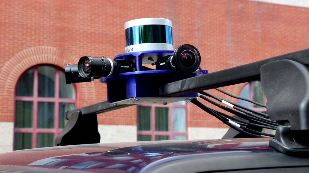
The contest aims to compute the so-called odometry, which is the change in the vehicle’s position over time. There will be one LiDAR and four cameras mounted on the car. The cameras will use normal optics, with ~70° field of view. The intrinsic and extrinsic parameters of the sensors are given, and a MATLAB Toolbox calibrates them.
Odometry can be estimated from LiDAR point clouds and/or camera images. A very accurate RTK-based GPS is also mounted that computes the ground truth data.

Testing Data
The organizers will define four different routes within Budapest. The length of each route will be about 5 minutes. The frequency will be 4 MPS (measurements per second) for the point clouds and the images. Ground truth data by RTK GPS will be available for the testing data. The four routes will be recorded four times in different conditions, they will be continuously published.
Contest Data
Ground truth data will be hidden from the competitors, they will be used to evaluate the solutions quantitatively. The first and final GPS locations will be given. Students should provide the GPS locations for each moment. Therefore, four (two-dimensional) GPS coordinates per second should be returned.
An example of the contest data will be published two months before the deadline final contest, until 15th November. An example of a possible submission will also be included. In the contest data, recordings for two long routes will be published that contain two pieces of 5-minute routes for the final evaluation. They are equal to two out of the four testing routes, the other two routes will be totally new.
Datasets are now available. First recordings are not perfect due to a cooling problem of the network within the car, however, participant can start the work using them. Fortunately, the problem was solved in August. GPS ground truth data are accurate, you can check it if you import the KLM file into an application, e.g Google Maps.

Evaluation
The route will be divided into several parts, the score will be separately processed.
The sum of two components for each part gives the final evaluation error:
- GPS coordinates will be converted to locations, and the Euclidean distances between the estimated and ground truth locations will be given as error values. These distances are calculated in meters. Each location will be evaluated at every recording moment. Therefore, four error values per second will be calculated. The final error value for the first component is the average of all location errors.
- At every moment, the speed vector should also be estimated concerning the previous frame. Both the direction and magnitude are considered, the unit for the magnitude should be meters/second. The Euclidean distance between the estimated and ground truth speed vectors gives the error for the moment. The final error regarding the second component is the average of all the vector distances.
Sensor-kit documentation and calibration data
The detailed description of the sensor-kit can be downloaded.
The LiDAR and the cameras are calibrated by the latest version of MATLAB. Obtained camera parameters can be downloaded as a plain text file.
Registration
To participate in the contest, please register on the site.
If you have any questions, please contact us at info@hackademix.hu.
